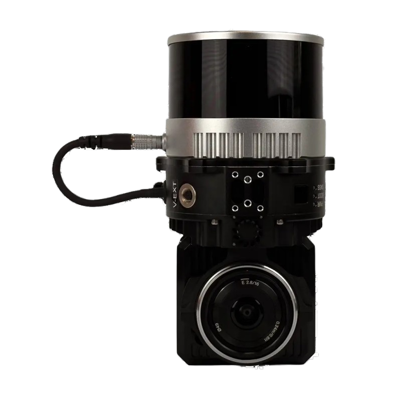
The Stonex XFLY is a compact and high-performance industrial imaging and measurement module designed for precise data capture and stable operation. Built for automated systems, it delivers exceptional accuracy, durability, and seamless integration in demanding industrial environments.
High-precision imaging and measurement performance
Robust construction for industrial applications
Fast data capture with stable long-term operation
Compact design for easy system integration
Ideal for automation, inspection, and quality control
Share on
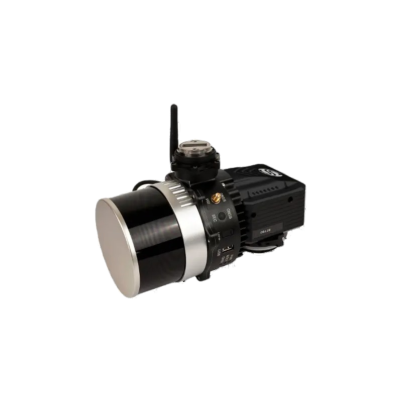
Stonex XFLY120
Advanced LiDAR Solution for DJI M350
The system combines advanced LiDAR technology and drone mobility to capture accurate terrain and asset data.
The platform supports fast and reliable data collection for construction, environmental, and surveying applications.
FLYpost software
The software observes and corrects misalignments between the INS and LiDAR, and georeferences the data into a geographic coordinate system. The post-processed INS trajectory, LiDAR scan files and camera images are converted to colored point clouds in LAS format for further processing.